Explore Westchester County
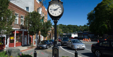
Katonah, New York
Katonah, New York was named after Chief Katonah the Native American from whom English colonists purchased what would become the Town of Bedford in Westchester County, New York. It is about 50 miles north of New York City.
Founded with the name Whitlockville, the town changed its name, and later was moved to its present site in 1897, when its former site (Old Katonah) was flooded by the construction of the Cross River Reservoir. More than 50 buildings were moved from the old site to New Katonah, were rolled on logs pulled by horses. The move was originally ordered to start in 1894, but litigation delayed the process by almost three years. Katonah was not the only village affected by New York City’s growing demand for water. The villages of Kirbyville and New Castle Corners were also condemned by the city but were never moved.
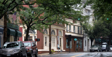
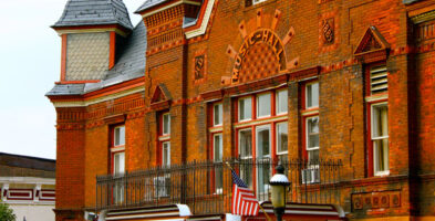
The Katonah Village Historic District was added to the National Register of Historic Places in 1983.
Primary and secondary schools:
Katonah is a part of the Katonah-Lewisboro School District. It contains Katonah Elementary School, although some residents go to the neighboring “Increase Miller Elementary School” in Goldens Bridge. In 2014, the school district voted to get rid of the Lewisboro Elementary school, moving elementary students around to other institutions within the district. This created huge controversy with parents, as many of them did not believe this change was necessary, and even filed petitions and hosted strikes against this act. Both schools matriculate into John Jay Middle School and John Jay High School. Katonah is also home to two (2) private schools, the co-educational, college preparatory school The Harvey School, and The Montfort Academy, a private, Roman Catholic high school that recently moved to Mount Vernon, New York.
Area
• Total 0.8 sq mi (2.1 km2)
• Land 0.7 sq mi (1.9 km2)
• Water 0.08 sq mi (0.2 km2)
Population (2010)
• Total 1,679
• Density 2,289/sq mi (883.7/km2)
Find out more by visiting Katonah’s official website at: katonahny.com
Read what the New York Times September 15, 2002 article has to say about living in Katonah